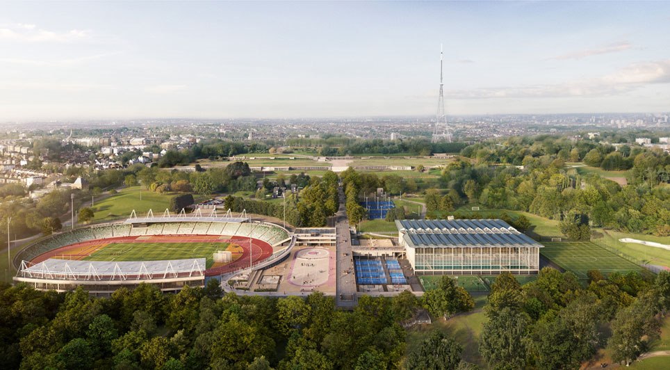
UK
UK Ireland
 Scotland
 London
If you're looking at ways to achieve highly accurate drone data, you may have heard about PPK and RTK.
But what are they and what's the difference?
Here's the basics of what you need to know:
In the realm of drone mapping and surveying, achieving centimetre-level accuracy is paramount. Two key techniques for attaining this level of precision are Post-Processed Kinematics (PPK) and Real-Time Kinematics (RTK). Understanding the differences between these methods is crucial for selecting the most suitable approach for your missions.
Ultimately, these two techniques are used to "correct" all of your images from a flight with the most accurate GNSS and orientation data, such that your outputs are as close to real life as possible! RTK "corrects" during the flight, PPK “corrects” after the flight.
Real-Time Kinematics (RTK):
RTK correction occurs during the drone flight in real-time, providing instant adjustments to ensure accurate positioning. This method requires a stable internet connection to receive correction signals from a reference station or network in real-time. RTK-enabled drones or rovers are equipped with receivers that communicate with ground-based reference stations or virtual reference stations (VRS) via a networked transport of RTCM via internet protocol (NTRIP) connection.
Advantages of RTK:
Real-time corrections enable immediate adjustments during flight.
Suitable for time-sensitive missions where instant feedback is essential.
Requires less post-processing time compared to PPK.
Can be more cost-effective for shorter duration flights.
Challenges of RTK:
Relies on stable internet connectivity, which may not be available in remote or obstructed areas.
Signal disruptions can lead to inaccuracies or gaps in data.
Limited coverage in areas with sparse or no network infrastructure.
Post-Processed Kinematics (PPK):
PPK correction is applied after the flight, utilising raw satellite data collected by the drone and a base station with known coordinates. Unlike RTK, PPK does not rely on real-time communication with reference stations. Instead, it requires the base station to record raw GNSS data for later processing. After the flight, the recorded data from both the drone and the base station are processed to achieve accurate georeferencing of images.
Advantages of PPK:
Greater flexibility as it does not depend on real-time communication.
Can achieve higher accuracy by processing raw satellite data after the flight.
Suitable for longer-duration flights and operations in remote or obstructed areas.
Provides robust performance in challenging environments with signal obstructions.
Challenges of PPK:
Requires additional time for post-processing and data synchronisation.
Initial setup involves deploying a base station and ensuring it records raw data throughout the flight.
May involve higher equipment costs for base station setup and processing software.
Ground Control Points (GCPs):
Ground Control Points (GCPs) play a crucial role in enhancing the accuracy and reliability of drone mapping and surveying. These strategically placed markers on the ground serve as reference points with precisely known coordinates. Integrating GCPs into PPK and RTK workflows further ensures precise georeferencing and enhances overall data accuracy, especially in challenging environments where signal obstructions may affect GNSS performance. By incorporating GCPs into your drone operations, you can significantly improve the quality and reliability of your geospatial data.
Rover examples:
Integrated - DJI Mavic 3 Enterprise w/RTK module
3rd party - Emlid Reach M2/M+ combined with 3rd party PPK kit (e.g. METTATEC PPK kit for DJI Phantom platform)
Base station examples:
Emlid RS2+, DJI D-RTK2, Trimble R12
Choosing between PPK and RTK depends on various factors, including mission requirements, environmental conditions, and equipment availability. Some applications may benefit from using a hybrid approach, combining the strengths of both techniques to optimise accuracy and efficiency. Generally, greater accuracy is obtained using PPK, but an RTK workflow can be more efficient in many cases (you can always combine the workflows and use PPK as a backup to your RTK data…).
In conclusion, PPK and RTK are invaluable tools for achieving centimetre-level accuracy in drone mapping and surveying. Understanding their differences and considerations is essential for selecting the most suitable method for your equipment and mission specifics. By leveraging the strengths of PPK and RTK, drone operators can ensure precise and reliable geospatial data collection for a wide range of applications.
There's so much more to unpack on the topic of PPK vs RTK for drone mapping (i.e. Ground Control Points, LoRa vs Caster, software preferences, file types and more), but we thought we’d leave it here for today!