UK
UK Ireland
 Scotland
 London
Crucial Services


Address
Haromin Cottage
Oswestry
SY11 4LA
About Crucial Services
Reduce on-site risks & optimize workflows with cost-effective, comprehensive insights & analysis with our drone land surveying services tailored to your needs
Drone Land Surveying vs Traditional Land Surveying
Quicker
Drone land surveys can cover large areas in a fraction of the time required by traditional ground-based surveys. A photogrammetry survey with high-resolution aerial images and laser scanning can collect millions of points a second. 3D models can be generated rapidly, enabling faster project progression and reduced downtime.
Safer
With drone technology, there is no need for our land surveyors or other contractors to access dangerous unstable terrain or work at height. Drones can easily reach remote or difficult-to-navigate areas, reducing the risks associated with traditional surveying by removing boots from the ground and enhancing workplace safety.
Cheaper
Drone land surveys eliminate the need for costly equipment and labour for clients and for us on-site. Traditional land surveying methods are more invasive and see less. Drones can collect more data in less time. By increasing productivity, drone technology reduces overall project costs and ensures a cost-effective solution for our clients.
Our Drone & Land Surveying Services
Drone Photogrammetry
High-resolution aerial imagery and 3D models provide accurate data for architects, planners, and project managers. This service allows for better decision-making and reduced costs throughout the project lifecycle.
Drone LiDAR
Accurate terrain data and surface features are essential for effective planning and design. Cut through vegetation to see the surface features beneath the canopy with a drone LiDAR or mobile LiDAR Survey, revealing hidden data.
Building Information Modeling (BIM)
3D Revit delivered to the client as an IFC file for use in ArchiCAD. Expert 3D modelling and data analysis for efficient, cost-effective building design, maintenance, and facility management.
Environmental Monitoring
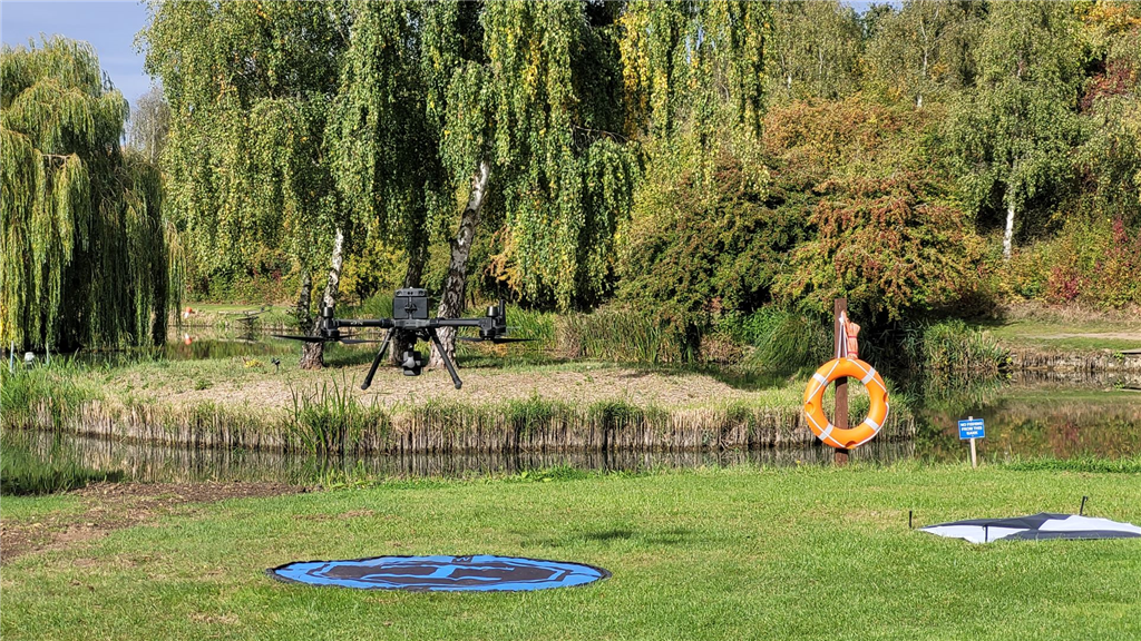
Drone Surveying DJI M300 drone with L1 lidar scanner. Assessment and analysis of environmental factors are critical for regulatory compliance and sustainable development. Our services support clients in the energy production, construction, planning and environmental management industries.
Volumetric Measurements
Stockpile volume calculations from drone survey data. Obtain accurate volumetric measurements of stockpiles and earthworks for improved resource management and project monitoring.
Asset & Infrastructure Inspection
Pylon inspection with a drone. Efficient and safe inspection of infrastructure and assets, including buildings, bridges, and energy installations, with high-resolution drone imagery.
3D Modelling & Digital Twins
3D model view of drone land survey using photogrammetry and laser scan for land & measured building survey. Create detailed and precise 3D models or digital twins of the built and natural environment for improved project planning and decision-making.
Construction Site Monitoring
Construction progress monitoring: structural steelwork. Monitor construction progress, track resources, and enhance stakeholder communication using up-to-date aerial imagery and data.
Topographical Surveys
Drone mapping: topographical surveys with drones. Comprehensive topographical surveys to capture detailed information about the terrain, natural features, and man-made structures on your site delivered in a 2D or 3D CAD drawing.
Measured Building Surveys
Measured building survey of a church - Close up x-ray of Laser Scan data of the church. Accurate and detailed measurements of existing buildings and structures, including floor plans, elevations, and cross-sections for design and planning purposes.
Site Setting Out
Precise site setting out services to ensure accurate positioning and alignment of construction elements, foundations, and infrastructure.
Boundary Surveys
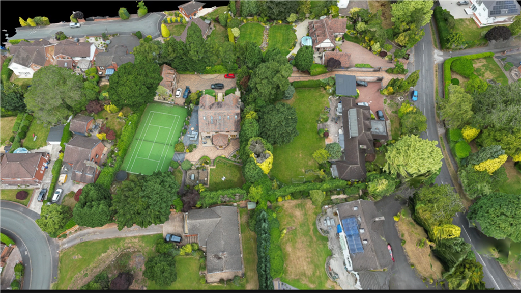
Determine and verify property boundaries, resolve disputes, and support legal professionals with professional boundary surveys.
Discover the advantages of using drone technology for land surveying projects.
Crucial Services.
5
out of 5
based on 4 ratings.
Reviews & Testimonials for Crucial Services

I have been working with Crucial Services for setting out steel work on a project site in Manchester, and I am thoroughly impressed with their top-notch services. Their professionalism, precision, and dedication to quality are truly commendable.
Their use of advanced technology in land surveying and drone inspections ensured that every aspect of the project was handled with utmost accuracy.
The seamless coordination and clear communication throughout the process made working with them a breeze. Their ability to meet deadlines without compromising on quality has been invaluable to our project's success.
I fully recommend Crucial Services to anyone in need of land surveying, drone inspection, and construction setting out works. Their commitment to excellence and customer satisfaction sets them apart in the industry.
June 13, 2024
Testimonial by
Stefan Niculescu - Stefan Engineering
Testimonial by
Stefan Niculescu - Stefan Engineering
Promptness of response : David contacted me very quickly after my enquiry. I explained what I needed and we discussed the job. He returned a competitive quotation the next day which I accepted and the job was completed within a week.
Quality of service : David downloaded the survey within a couple of days of making it. While he was at the property he made suggestions about future work I was planning and was very helpful to one of the neighbours.
Value for money : Although not cheap, the survey was competitive, and was both quick and thorough. Much easier than having scaffolding and a physical examination.
Professionalism : David has a drone pilot’s licence, and is a chartered surveyor, so is able to give advice on future work needed. His handling of the drone and his explanations of what it was doing were fascinating.
October 01, 2023
Testimonial by
J Ellis
Testimonial by
J Ellis
We've worked well with David as a setting out engineer but recently got the opportunity to witness the firm's latest 3D modelling of a live site via drone capture and modelling software and was absolutely blown away!
The applications for this output are endless, capturing heritage assets and 3d models of museum pieces has been mooted BUT, with David a CAA Licenced pilot - the CDM Health and Safety aspects of the service really leap out at me:
Surveying a building after fire damage, no risk to the surveyor and much safer planning for the construction team, opportunities to save buildings which might otherwise be demolished. Surveying roofs and Chimneys, either after storm damage or for preventative maintenance - no scaffolding required, quicker, cheaper, SAFER....
So Fire Services, Insurance Underwriters, Home and Commercial Premises owners.... check out David's work and ask for a quote, you'll be stunned how much you save on finding out the true situation outside of your practical sight lines.
July 13, 2022
Testimonial by
Charles OKell, Director - UK Pro Build Ltd
Testimonial by
Charles OKell, Director - UK Pro Build Ltd
I've worked with Dave for almost 15 years. For some time we were colleagues but subsequently he has provided land and measured building surveying services to my clients. As well as his surveying skills I find that his wider understanding of and interest in what is required for particular jobs, in terms of scope and technology, results in his services being really valuable in producing accurate information that can be readily and usefully applied to the projects I work on.
April 19, 2022
Testimonial by
Hugh Jackson Architect
Testimonial by
Hugh Jackson Architect
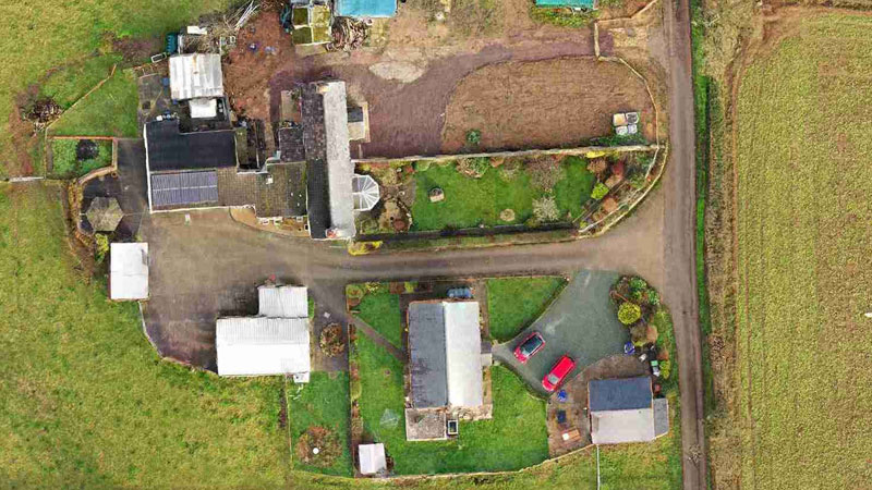
Gallery
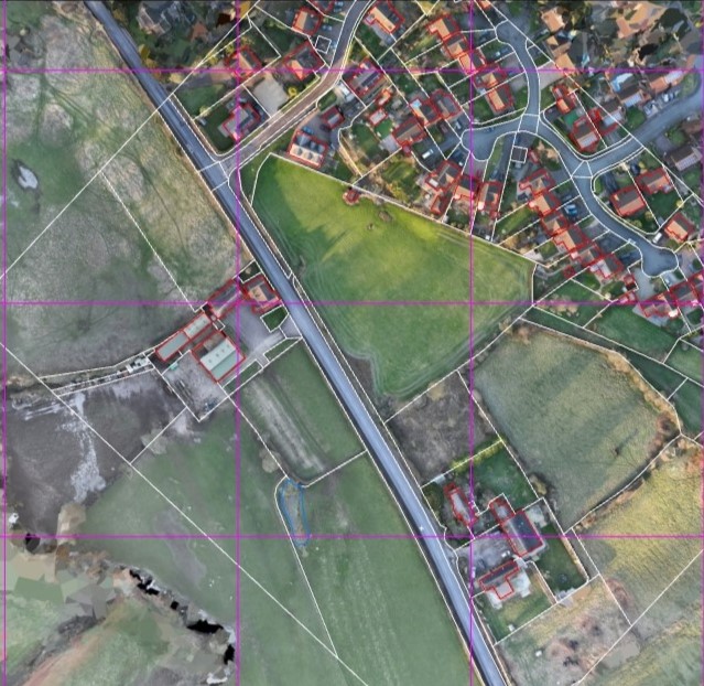
Drone and ground-based boundary surveys
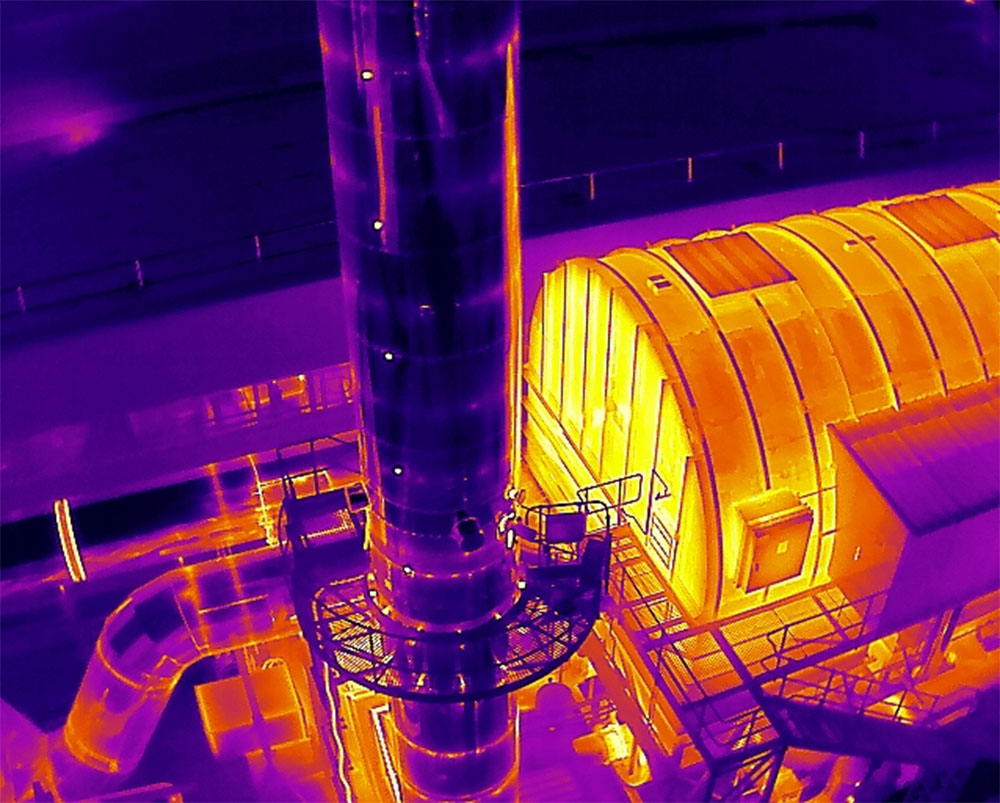
Drone thermal inspection of industrial plant
drone thermal roof inspection with significant standing water, blocked drainage
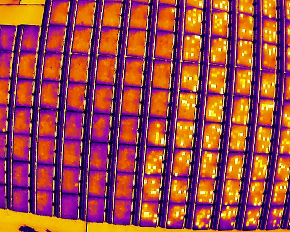
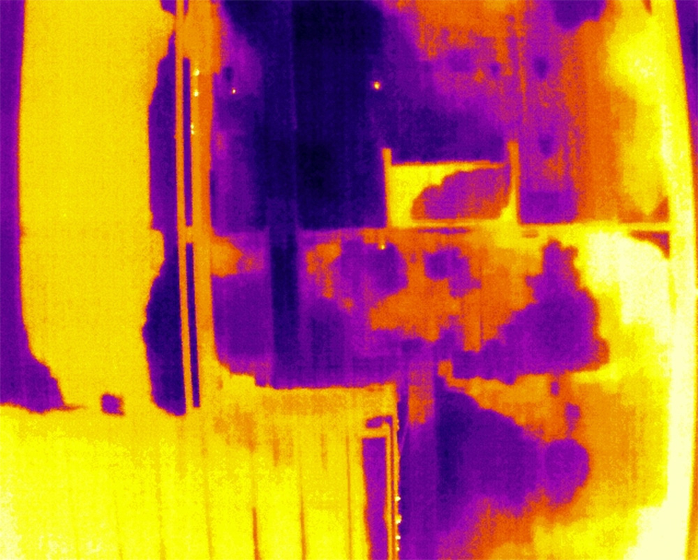
Thermal PV inspection survey showing array with faulty cells
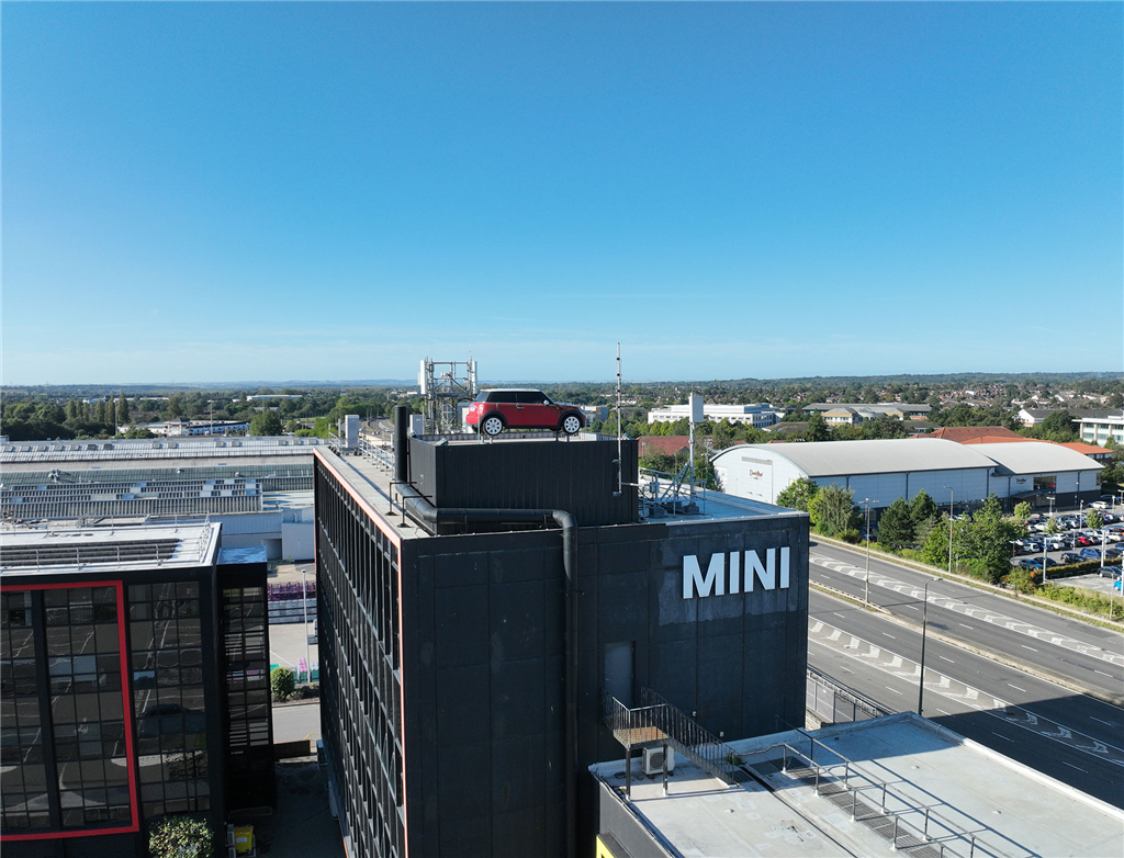
Drone Survey at BMW Mini plant
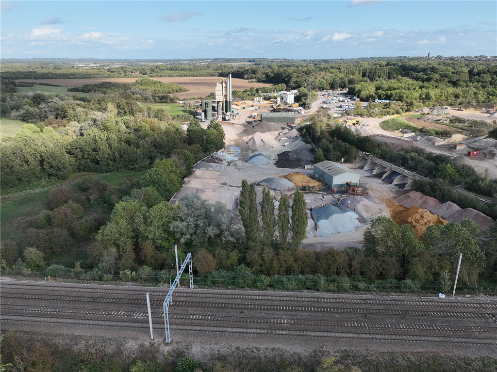
Drone survey for accoustic engineer of railway and quarry
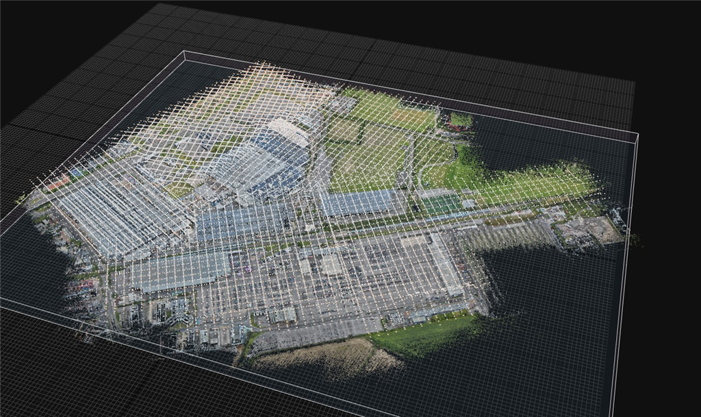
BMW Mini plant - photogrammetry survey sparse point cloud with camera positions

BMW Mini plant - photogrammetry survey sparse point cloud
drone land survey with DJI M300 with L1 payload
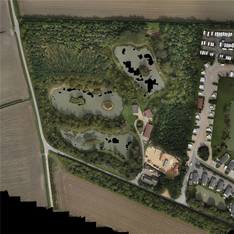
Drone survey: Orthophoto
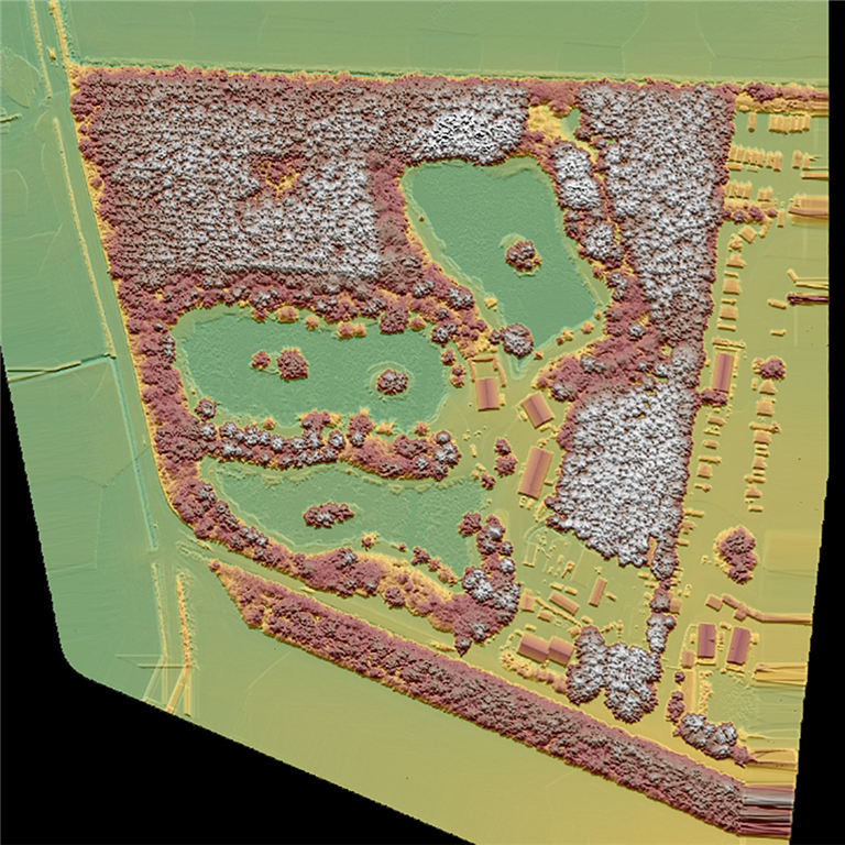
Drone survey: Digital Surface Model

Drone survey: Digital Terrain Model
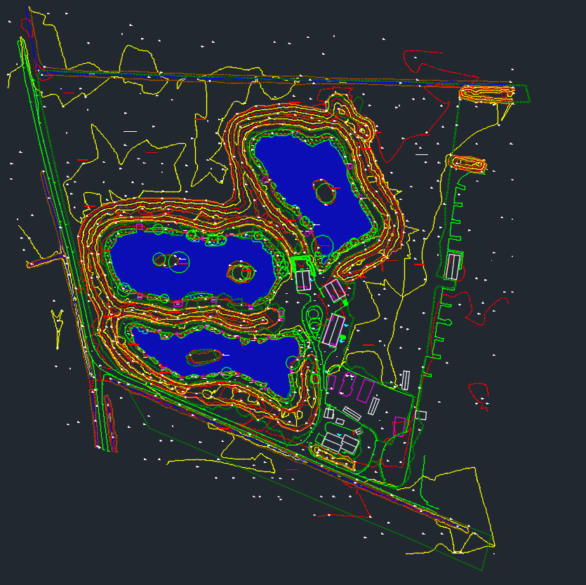
Drone survey: Topographical survey
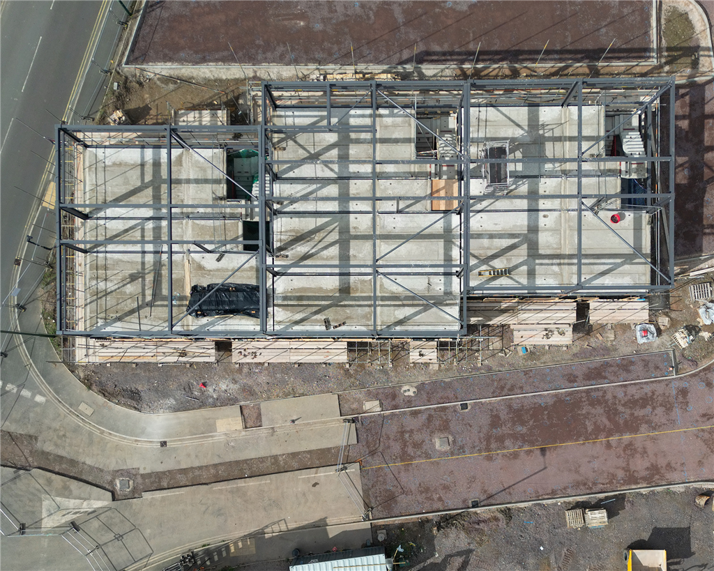
Construction progress monitoring A
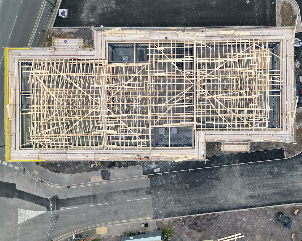
Construction progress monitoring B
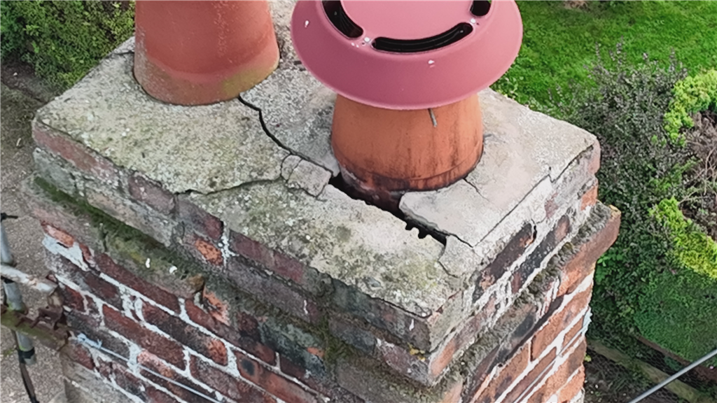
Roof inspection
3d model of planning application site
Orthographic image
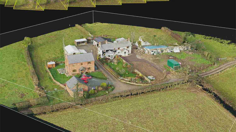
Photogrammetry modelling

Close-range photogrammetry
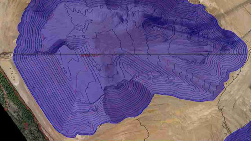
Earthwork volumes

Quarry survey
Videos
Facebook Feed
Location Map
Crucial Services Serves The Following Counties
Crucial Services Serves The Following Towns