UK
UK Ireland
 Scotland
 London
First Point Surveys Ltd


Address
28 Claro Court Business Centre
Claro Road
Claro Road
Harrogate
HG1 4BA
Opening Hours
Today
08:30-17:30
View All Hours
Sunday
Closed
Monday
08:30-17:30
Tuesday
08:30-17:30
Wednesday
08:30-17:30
Thursday
08:30-17:30
Friday
08:30-17:30
Saturday
Closed
About First Point Surveys Ltd
First Point Surveys Ltd. is an independent Yorkshire-based practice of land, building and utility surveyors specialising in the following:
Our equipment consists of the most up-to-date laser-measuring devices including Leica P series laser scanners and Leica MS series robotic total stations. Utility surveys are undertaken using IDS ground penetrating radar (GPR) and RadioDetection electro magnetic locators (EML).
Post-survey data processing is carried out using the latest time saving software and results can be supplied in various formats including AutoCAD (DWG & DXF), Adobe PDF and ASCII. All survey data can also be provided in full colour on paper or film in any size from A4 to A0.
Topographical Surveys
We can provide Topographical (or Land) Surveys to meet your specification with the delivered product usually being in CAD and PDF electronic formats although other formats and prints are available on request.
Measured Building Surveys
The accurate measurement and production of plans, sections, elevations and visualisations of a building.
Underground Utility Surveys
Using the latest techniques we can locate, mark out and survey the positions of underground utilities across your site, including but not limited to sewers, drainage, electric, gas, water, oil, CATV, comms, anomalies. We will also map above ground utilities such as telephone and power cables to form a complete picture.
Monitoring
The measurement and tracking of the alteration and shape or dimension of a structure/feature whether natural or man made.
Photogrammetry
The practice of determining the geometric properties of objects from photographic images, output is typically a map, drawing or 3D model.
Most commonly used to create topographic maps for the Ordnance Survey, photogrammetry is the practice of using photographic images of physical objects to obtain information. In survey practice, photogrammetry is typically used to record information concerning buildings or structures to create 3D data, which in turn can be used for whatever the client requires. The data output can range from a 2D building elevation to a full photo-realistic rendered model and are normally instructed by engineers, architects, planners, and anyone needing precise maps of an area or feature.
Laser Scanning
Laser-scanning techniques reduce time and costs with the ability to improve design processes, reducing the risk of data collection errors.
Using either a Laser Scanner or Photogrammetric Software, we can produce 3D point cloud data. This data looks as its name suggests, like a giant cloud of 3D points, each taken on the surface of the building or objects being scanned. Its density can be specified by the client (within certain tolerances), and has many uses, including English Heritage Surveys, geology and flood-risk assessments. The technology has been around for some time, and we are finding new ways to use this data every month.
Underground Utility Tracing
Process of identifying and labeling utility mains which are underground, including natural gas, fiber optics, storm drains, water mains, cable television and wastewater pipes.
Boundary Determination
Title deeds are the most important documents concerning boundary determinations, and should not be confused with Land Registry plans. Although potentially simple to resolve, boundaries cause more problems between neighbours than any other matter. Disputes can end up in court simply due to a misunderstanding of the issues involved. We aim to avoid this whenever possible, and look to mediate between neighbours to find a resolution.
- Topographical Surveys (incorporating GPS)
- Measured Building Surveys: Floor Plans, Sections & Elevations
- Boundary Determinations - Disputes
- Flood Risk Assessment Surveys
- Volume Calculations – Quarry Stock, Landfill, Spoil Heaps, etc.
- Deformation Monitoring
- Underground Utility Surveys Ground Penetrating Radar (GPR)
- Photogrammetry: Building Elevations and Remote Surveying
- Laser Scanning - 3D Point Clouds
- As Built Surveys
Our equipment consists of the most up-to-date laser-measuring devices including Leica P series laser scanners and Leica MS series robotic total stations. Utility surveys are undertaken using IDS ground penetrating radar (GPR) and RadioDetection electro magnetic locators (EML).
Post-survey data processing is carried out using the latest time saving software and results can be supplied in various formats including AutoCAD (DWG & DXF), Adobe PDF and ASCII. All survey data can also be provided in full colour on paper or film in any size from A4 to A0.
Topographical Surveys
We can provide Topographical (or Land) Surveys to meet your specification with the delivered product usually being in CAD and PDF electronic formats although other formats and prints are available on request.
Measured Building Surveys
The accurate measurement and production of plans, sections, elevations and visualisations of a building.
Underground Utility Surveys
Using the latest techniques we can locate, mark out and survey the positions of underground utilities across your site, including but not limited to sewers, drainage, electric, gas, water, oil, CATV, comms, anomalies. We will also map above ground utilities such as telephone and power cables to form a complete picture.
Monitoring
The measurement and tracking of the alteration and shape or dimension of a structure/feature whether natural or man made.
Photogrammetry
The practice of determining the geometric properties of objects from photographic images, output is typically a map, drawing or 3D model.
Most commonly used to create topographic maps for the Ordnance Survey, photogrammetry is the practice of using photographic images of physical objects to obtain information. In survey practice, photogrammetry is typically used to record information concerning buildings or structures to create 3D data, which in turn can be used for whatever the client requires. The data output can range from a 2D building elevation to a full photo-realistic rendered model and are normally instructed by engineers, architects, planners, and anyone needing precise maps of an area or feature.
Laser Scanning
Laser-scanning techniques reduce time and costs with the ability to improve design processes, reducing the risk of data collection errors.
Using either a Laser Scanner or Photogrammetric Software, we can produce 3D point cloud data. This data looks as its name suggests, like a giant cloud of 3D points, each taken on the surface of the building or objects being scanned. Its density can be specified by the client (within certain tolerances), and has many uses, including English Heritage Surveys, geology and flood-risk assessments. The technology has been around for some time, and we are finding new ways to use this data every month.
Underground Utility Tracing
Process of identifying and labeling utility mains which are underground, including natural gas, fiber optics, storm drains, water mains, cable television and wastewater pipes.
Boundary Determination
Title deeds are the most important documents concerning boundary determinations, and should not be confused with Land Registry plans. Although potentially simple to resolve, boundaries cause more problems between neighbours than any other matter. Disputes can end up in court simply due to a misunderstanding of the issues involved. We aim to avoid this whenever possible, and look to mediate between neighbours to find a resolution.
For any other questions or enquiries, please contact us!
First Point Surveys Ltd.
5
out of 5
based on 3 ratings.
Reviews & Testimonials for First Point Surveys Ltd

Matthew Harrison and his team at First Point Surveys are a pleasure to work with, offering a wide range of surveying techniques. They’re up to date surveying equipment and earthworks drawing software means that we can offer a full design service to our clients.
I highly recomend First point Surveys.
I highly recomend First point Surveys.
April 07, 2023
Testimonial by
Guy Tulloch
Testimonial by
Guy Tulloch
I needed a topographical survey to help in the preparation of a flood risk assessment which I needed for a prospective property purchase. Having spoken to a few potential suppliers of this service, it was apparent on talking to Matthew that these guys were the best option, in addition not being a competitive price.
Phil did the work, which was over and above my expectations, and the report was sent to me within 24 hours. This is an impressive company which has the flexibility you'd find in a great small business, and the technical ability, equipment and professionalism of any major business in this area of work. Thank you.
Phil did the work, which was over and above my expectations, and the report was sent to me within 24 hours. This is an impressive company which has the flexibility you'd find in a great small business, and the technical ability, equipment and professionalism of any major business in this area of work. Thank you.
October 04, 2021
Testimonial by
Steve T
Testimonial by
Steve T
reat local company. Friendly husband and wife team who assisted me with my query very efficiently. Great service, thank you.
January 01, 1900
Testimonial by
F. Barker
Testimonial by
F. Barker
Gallery
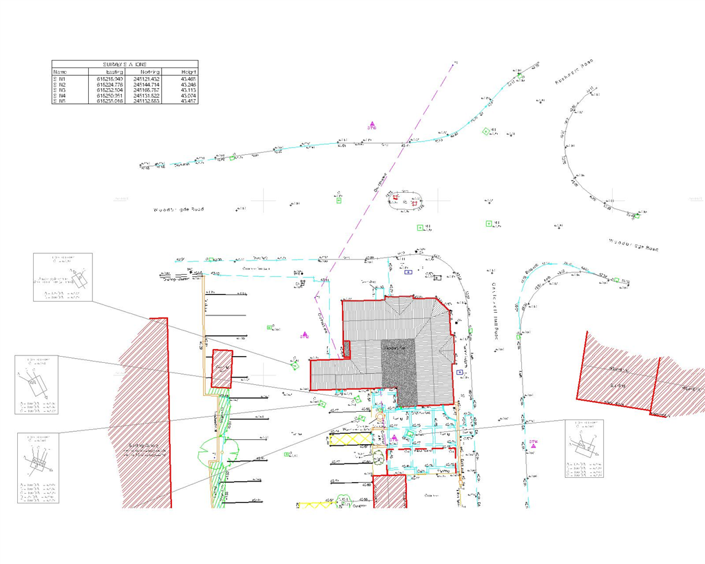
Topographical survey
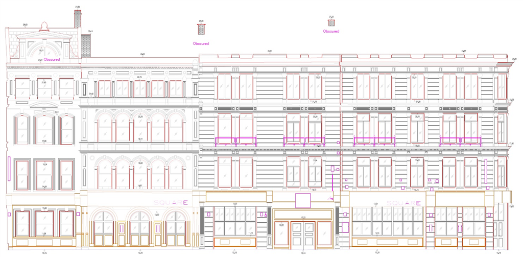
Architectural building elevations Leeds
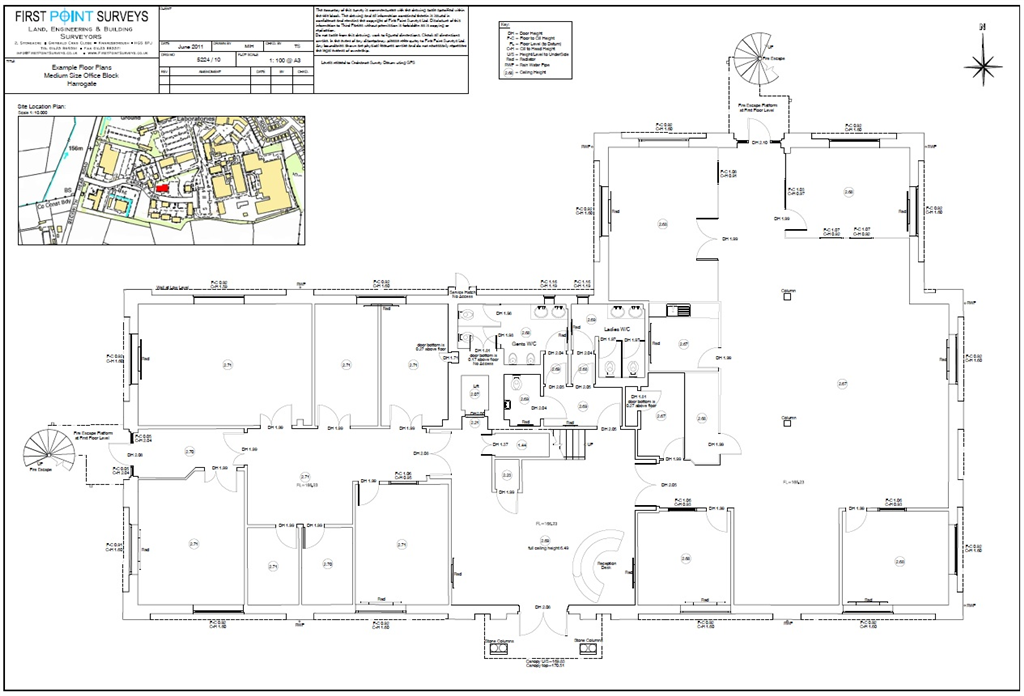
Measured building survey floor plans Office Block
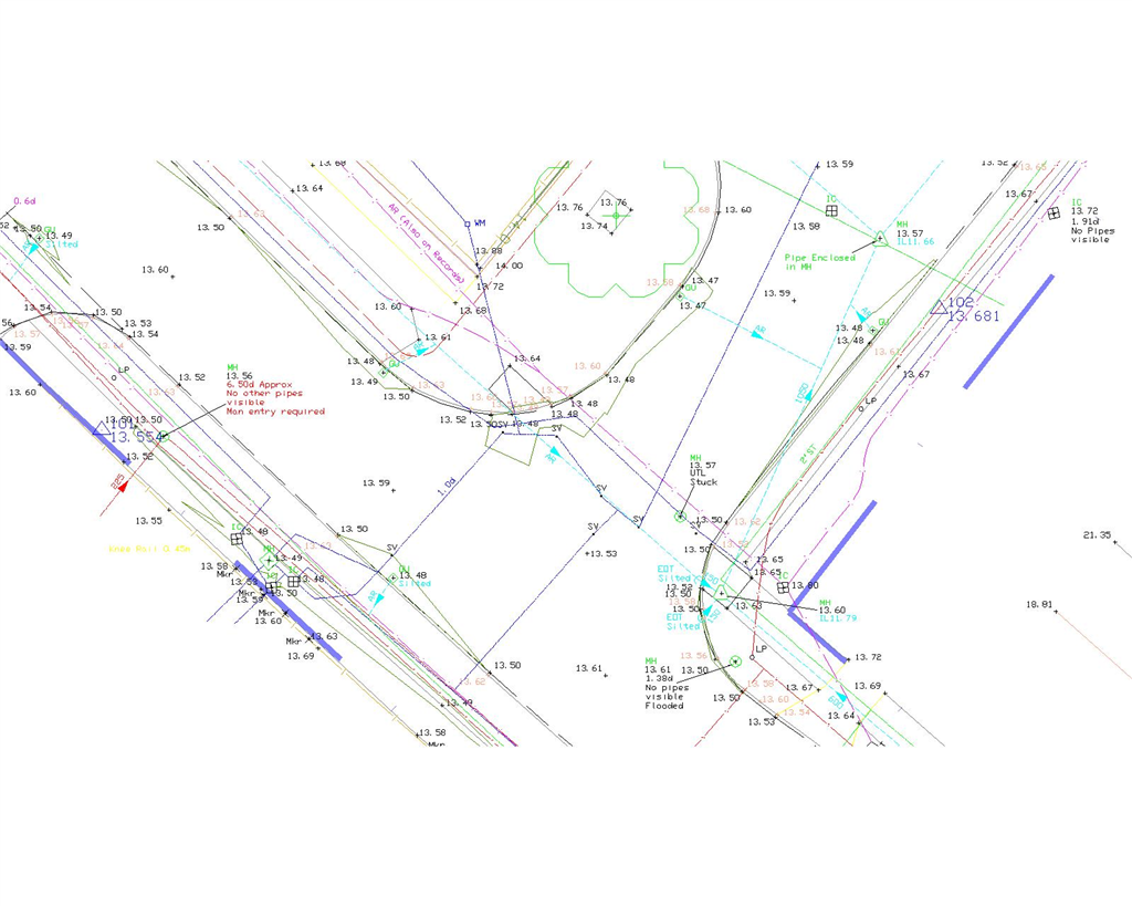
Underground Utility Survey (EML & GPR)
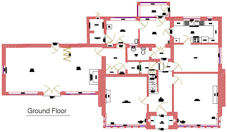
Measured Building Survey - Floor Plan
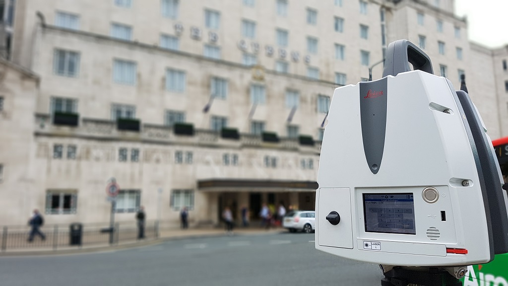
Elevation survey of the Queens Hotel in Leeds using a Leica P40 laser scanner
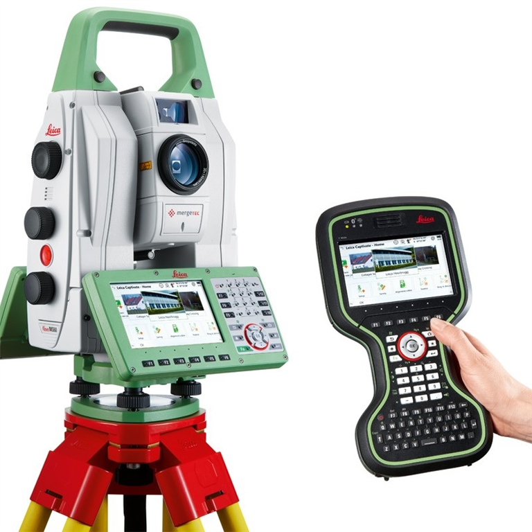
Leica MS50 total station for laser scanning and topographical surveys
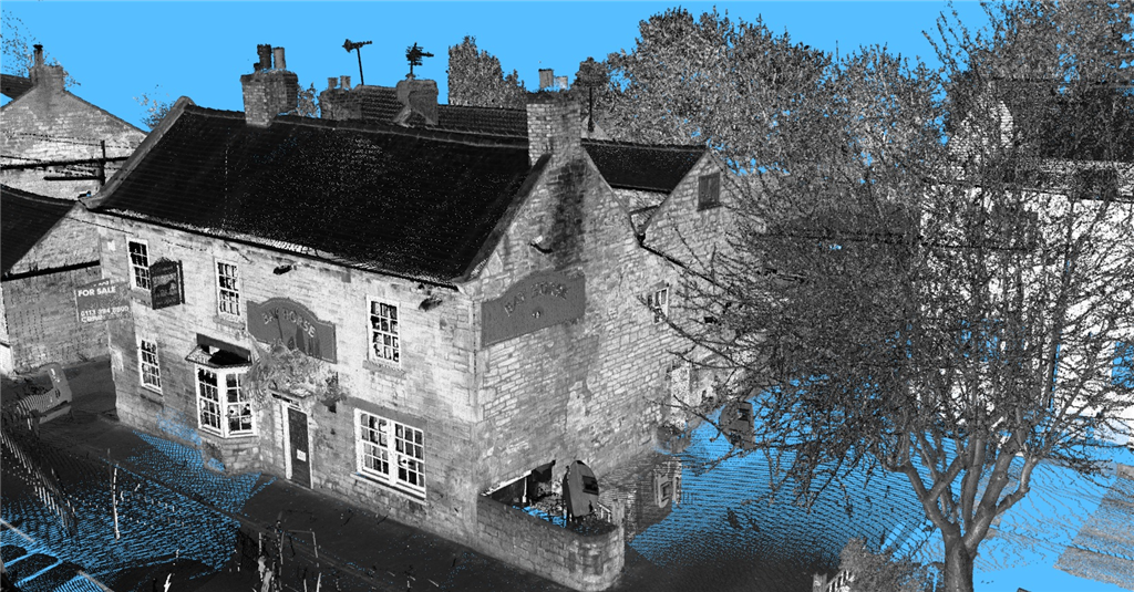
Laser scanning point cloud
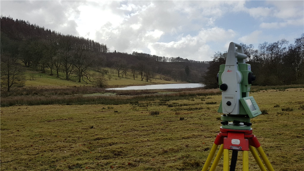
Lake Topographical Survey
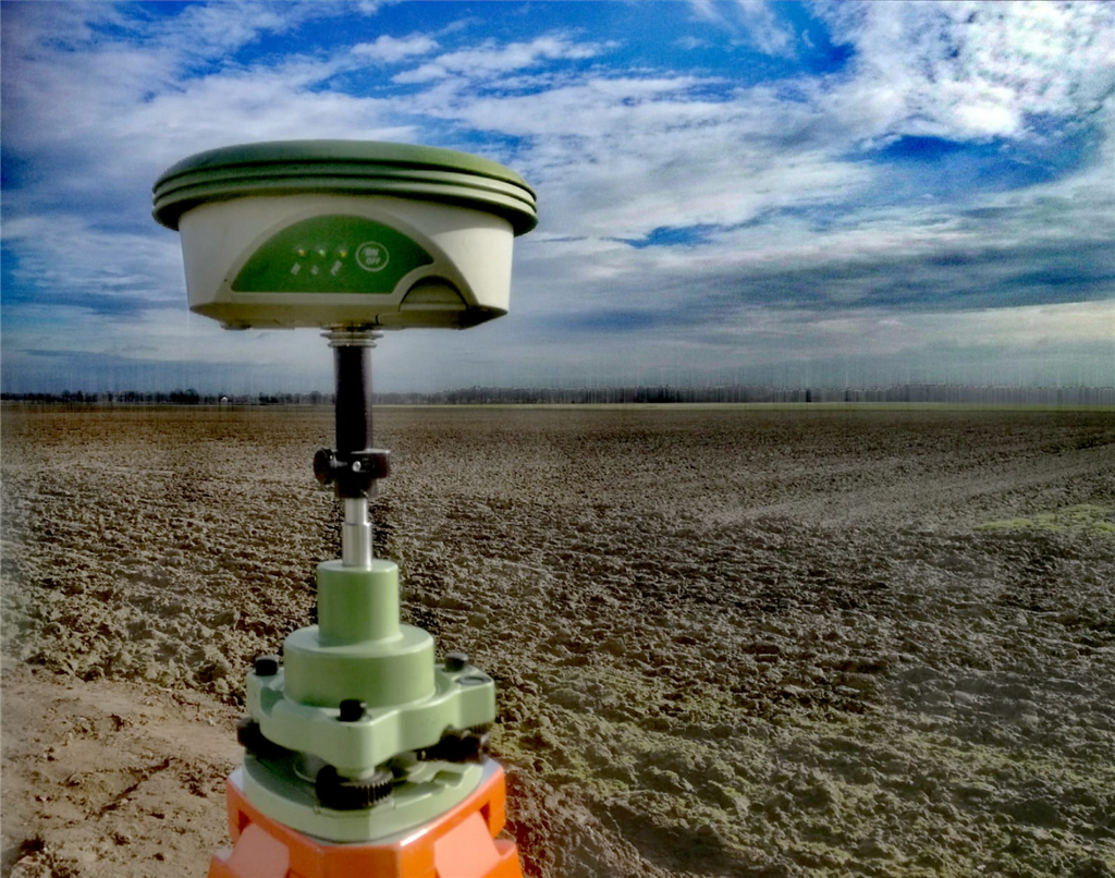
GPS (GNSS) control station survey
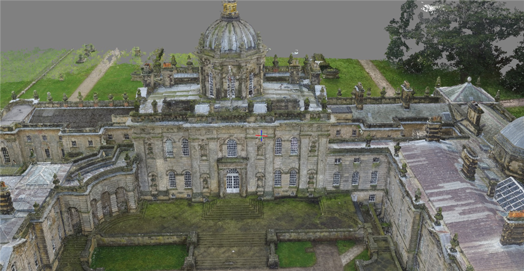
Castle Howard, York - Point Cloud from Drone

First Point Surveys, Knaresborough
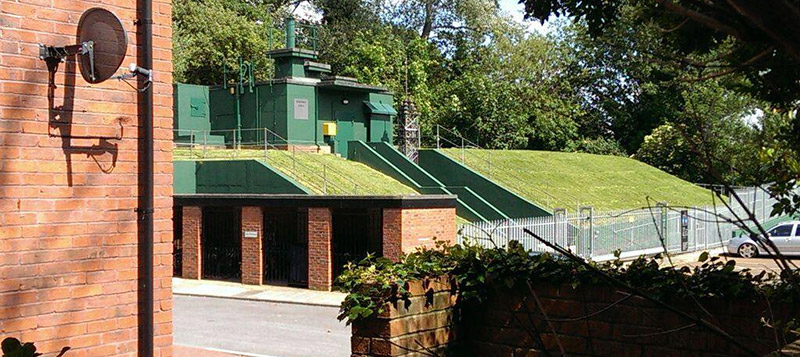
Nuclear Bunker, York
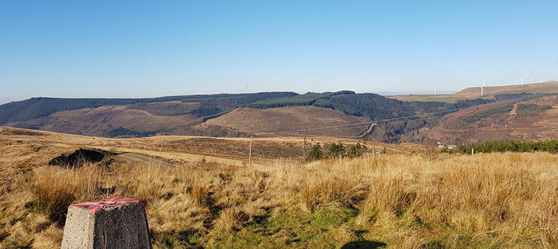
Trig monument, Wales
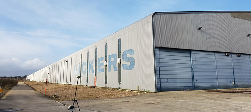
Former Vickers Tank factory in Leeds
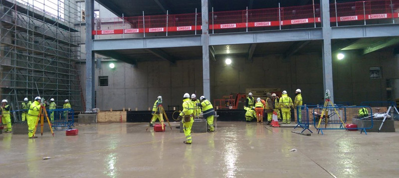
Engineering works Allerton Park Waste Recycling centre
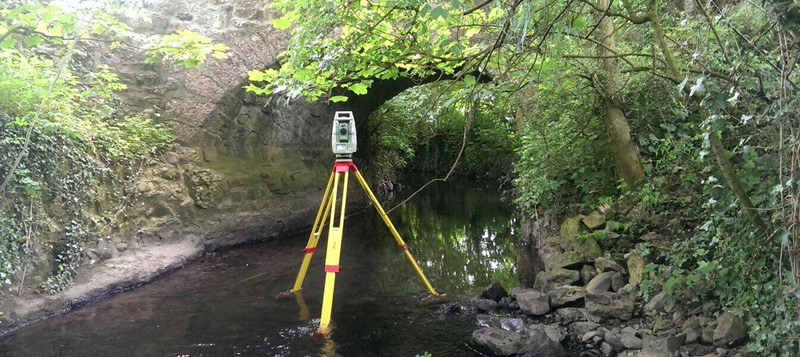
Robotic total station river survey
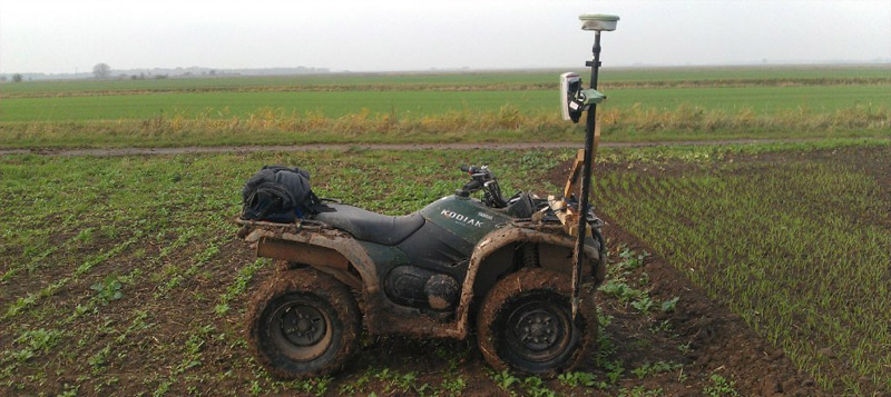
GPS topographical survey using quad bike
Products & Services
Location Map
First Point Surveys Ltd Serves The Following Counties
Find First Point Surveys Ltd in